01 / Sea Chart
Your journeys
Record GPS tracks, organise routes and exchange GPX or KML files.
 Sea Chart®
MADE FOR DAYS ON THE WATER
Explore the shoreline with marine charts, weather and practical boating tools in Sea Chart for Android.
Get the Android app23 languages. One coastal companion. Choose your language in the app.
01 / Explore
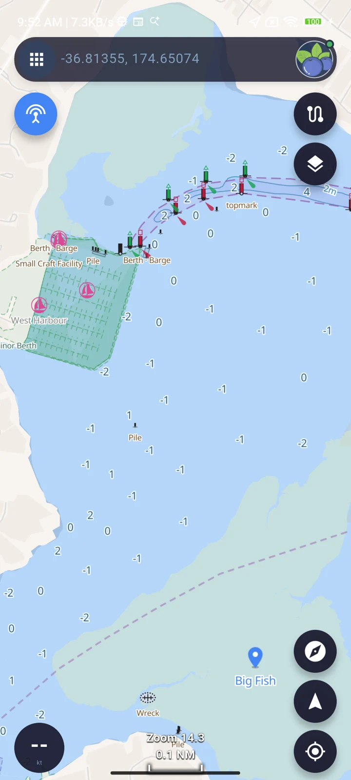
Explore the layers that bring your surroundings into focus.
Explore nautical charts with seamarks, coastal details and useful points on the map.
Sea Chart / Android
02 / Charts
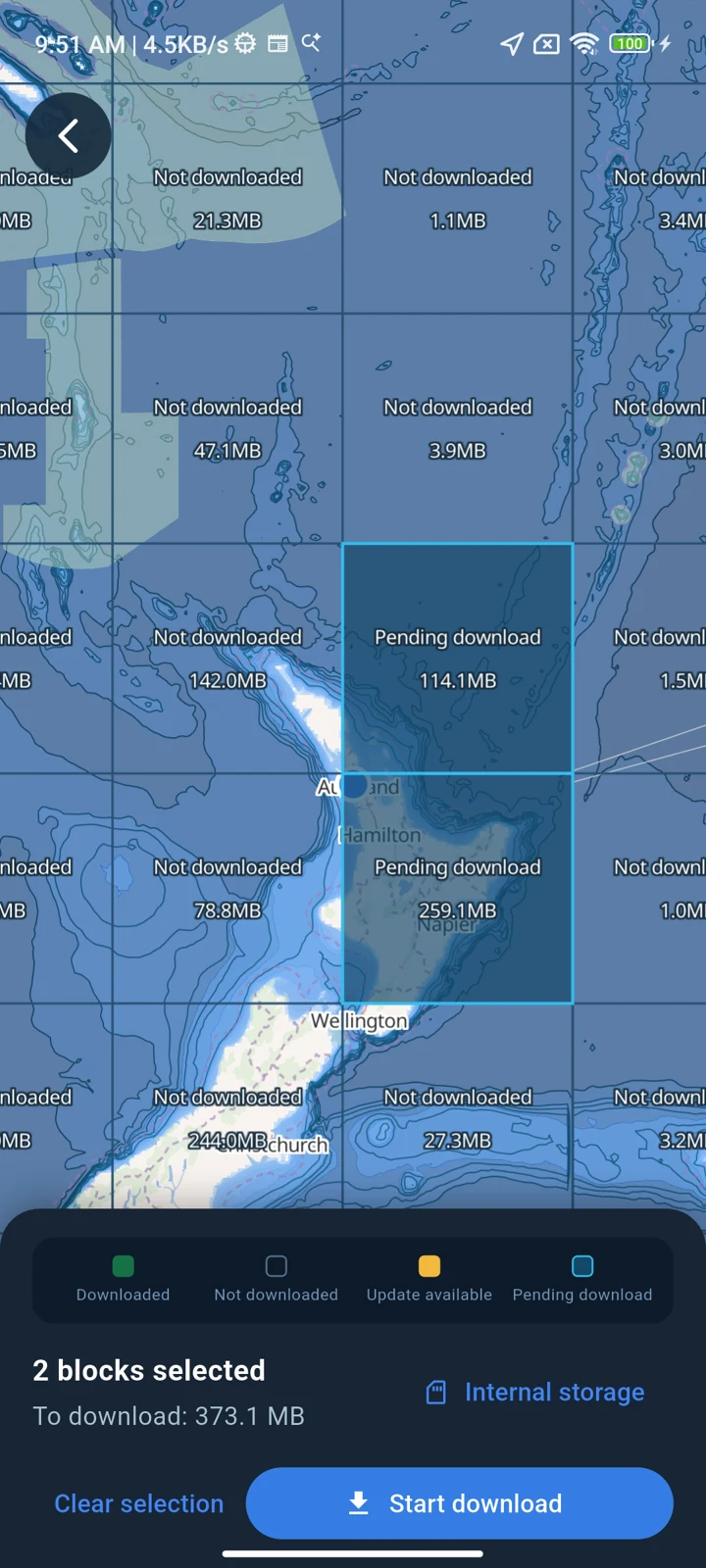
Download your chart regions before you leave. Keep exploring when mobile coverage fades.
Select the regions and detailed chart blocks you need.
Save available basemap, nautical chart and bathymetry data to your device.
Check your downloads before departure. Weather forecasts can also be cached in advance.
03 / On board
A fishing trip, a weekend under sail or an afternoon at anchor. Keep the useful things close.
01 / Sea Chart
Record GPS tracks, organise routes and exchange GPX or KML files.
02 / Sea Chart
Set an anchor position and watch radius. Receive an alert when your position moves outside the circle.
03 / Sea Chart
Connect compatible equipment to view received vessel positions and details on the chart.
04 / Sea Chart
Explore tide predictions, curves and high and low water times.
05 / Sea Chart
Explore wind, waves, rain and other forecast layers. Cache weather data before leaving coverage.
06 / Sea Chart
Check fish activity, moon phase and sunrise and sunset times alongside tides.
04 / Good to know
Downloaded charts remain available offline. Weather needs internet access to refresh; cached forecasts reflect their download time. Data coverage varies by location.
AIS / NMEA uses data from compatible connected equipment. Your phone does not become an AIS receiver or transmitter.
Check location permissions, GPS reception, power settings and alert volume before use. Keep a proper watch on board.
23 languages. One coastal companion. Choose your language in the app.
Sea Chart / Android